Drone Survey

      Rs

      Description


      Drone Survey: Capture Data, Accelerate Insights

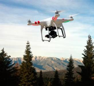
      Revolutionize your data collection with our comprehensive Drone Survey services. We leverage cutting-edge drone technology and expert analysis to provide you with accurate, high-resolution data, significantly reducing costs and timelines compared to traditional survey methods.

      What We Offer:

      Our Drone Survey services encompass a wide range of applications, including but not limited to:

      • Aerial Photography & Videography: High-resolution imagery and video capturing stunning visuals and detailed site information for various purposes, including marketing, construction progress monitoring, and environmental assessments. Options for various resolutions and formats available.
      • 3D Modeling & Mapping: Create precise 3D models and orthomosaic maps of your site, providing a comprehensive visual representation of terrain, structures, and vegetation. Ideal for planning, design, and construction projects. Deliverables include:
        • Orthomosaic: A georeferenced mosaic of aerial images, stitched together to create a seamless, high-resolution map.
        • Digital Surface Model (DSM): A 3D representation of the earth's surface, including buildings and vegetation.
        • Digital Terrain Model (DTM): A 3D representation of the bare earth surface, excluding vegetation and man-made objects.
        • Point Cloud Data: A massive set of 3D points representing the surveyed area, offering unparalleled detail and accuracy.
      • Thermal Imaging: Detect temperature variations, ideal for identifying energy loss in buildings, locating leaks, monitoring infrastructure health, and conducting precision agriculture assessments.
      • LiDAR (Light Detection and Ranging): High-accuracy data acquisition for precise measurements of elevation, distance, and other crucial parameters, suitable for detailed topographic surveys and volumetric calculations. (Available as an add-on service – please inquire for pricing).
      • Construction Monitoring & Progress Tracking: Regular drone surveys provide accurate progress updates, identify potential issues early on, and help ensure projects stay on schedule and within budget.
      • Agriculture & Precision Farming: Monitor crop health, assess irrigation needs, and optimize farming practices for increased yield and efficiency.
      • Environmental Monitoring & Conservation: Assess environmental impact, monitor deforestation, track wildlife populations, and conduct detailed habitat surveys.

      Benefits of Choosing Our Drone Survey Services:

      • Cost-Effective: Significantly reduces costs compared to traditional survey methods.
      • Time-Saving: Faster data acquisition and processing leads to quicker project completion.
      • Enhanced Accuracy: High-resolution imagery and advanced data processing techniques ensure precise measurements.
      • Increased Safety: Minimizes risks associated with hazardous terrain and inaccessible areas.
      • Comprehensive Data: Provides a wealth of information for informed decision-making.
      • Environmental Friendly: Minimizes environmental impact compared to traditional methods.

      Our Process:

      1. Consultation: We discuss your project requirements and tailor a solution to your specific needs.
      2. Site Survey: We conduct a pre-flight site assessment to ensure safe and effective data acquisition.
      3. Data Acquisition: We utilize our advanced drone technology to collect high-quality data.
      4. Data Processing: Our experienced team processes the data using industry-leading software.
      5. Delivery: We provide you with the processed data and relevant reports in your preferred format.

      Contact Us Today!

      Get a free quote and let us help you unlock the potential of drone technology for your next project. Contact us at [Your Contact Information] to discuss your requirements.

      Seller Details

      G1Kart.com

      Guwahati, assam

      ["Manufacturers"]

      Looking for Best Price

      VIDEO WALL

      LED TV

      CCTV CAMERA

      Tags: Drone Survey